Jan. 22, 2007
- Bug fix in visual item displaying digits for small numbers.
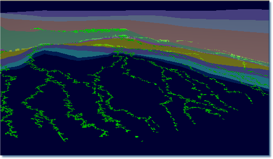
- Added paleo structure and paleo STS movie tools
- Allowing contours on paleo-movies
Dec. 10, 2006
- Bug fix in unconformity handling
- Project notes feature
- Bug fix in reading TEMIS3D file
Oct 19, 2006
- Unlimited number of fault planes to be used in migration modeling and display on cross sections
- Bending temperature curve through allocthonous salt.
- Natural neighbors gridding for gridding seismic data fast and smooth.
- Save to and recreate cross sections from visuals.
- Lots of small improvements
Oct 1, 2006
- Added automatic temperature correction through allochthonous salt body.
- Added support for ArcGIS native adf files. Just drag any of the adf files in the folder in to Trinity to load the grid.
- Shaded relief option for map view. Helps to show details not possible using contours or color map.
- Added natural neighbors algorithm and enhanced interface designs for gridding.
- Added a distance measuring tool.
Aug 22, 2006
- Added upper case scenario for ArcInfo ASCII grid import (NOAA 2 minute topo data)
- Added null value condition for ASCII grid import
- Added R-sqaured to temperature calibration plot.
- Allows miles instead of kft scale on map legend when distance is in feet.
Aug 6, 2006
- Added delay behavior for trap tooltips, so it does not pop when user just moves mouse over it quickly.
- Fixed an old problem with compaction and unconformity.
- Added legend for the temperature time, depth and correlation plots
- Added points on temperature correlation plots for current map, in addition to measured data. The new points will be a good visual comparing Trinity and Genesis for the current map (i.e. the source rock).
Aug 2, 2006
- Allows unlimited thickness change layers and unlimited thickness change events (episodes) for the same layer. This is important for correctly modeling salt movement. Immediate improvements has been shown on the North Sea example, where later Oligocene movement of the salt is apparent, in addition to the main Cretaceous movement. This feature should remain in T3 for a period of time.
- Unconformity on cross sections and burial history now does not show a brown color for the eroded section. Instead, the color of the missing formation is used and multiple eroded layers of the unconformity are not distinguished.
- Cross plot of calculated temperature vs measured temperature from all Genesis models. The correlation responds to change in present day scaler and the temperature curve. This allows quick QC of Trinity thermal model against measurements.
July 29, 2006
- Added temperature depth and temperature history plots on the instant burial history tool. Any Genesis input and modeled temperatures will be displayed on this if the burial history cursor is close to the well location. This allows quick QC of Trinity thermal model against Genesis models.
- Added a html style navigation tab class for handling the switching of the different plots - to make it very intuitive
July 24, 2006
- Fixed bug import of Temis3D files
- Added Pressure map type and the flash calculator can pick up pressure from associated map sa age as the structure map.
- Allows the capilarry maps (facaies and faults) to use pressure units as well as the column height units.
July 20, 2006
- Allows to extract/digitize map values to a visual item, or scribbles
- Link to Temis3D output for batch reading temperature/pressure etc. maps.
- Added two more GOR calibrations, Hanafy et al 1997 (Egyption oils) and Velarde et al. 1997
- Migration paths max number of segments increased.
- Back ground color, scribble color, and polygon color are now saved in Document.
July 7, 2006
- version 2.5 release
- Copy temperature and pressure history for any location to spreadsheet.
- Allow 3D scatter points to be drawn as disks.
- 3D viewer contour flashing problem fixed - had to do with glNormal not being reset.
- Trap tool tip popup is now available in 3D window
- Spider maps allows seeds with volumes per unit area.
July 3, 2006
- Tool tip for accumulations improved to allow multi line and CGR
- Flash calculator made accumulations now compatible with migration tools (syringe and spiders) to add more volumes.
Last update 6/17/06:
- Re-migration -- accumulations on paleo-structure can migrate again when structure is changed.
- Copy all accumulations to spreadsheet for statistical analysis.
- Lithology color fill on cross sections.
- 3D viewer surface no longer partially hides draped visual items, migration paths or accumulations.
- The correlation gridding dialog window can be resized for easier editing of the relationship.
- Added support for Landmark culture exported from SMT
- Hard drive signature for T3 users.
- Visual item as well in 3D line thickness bug fix.
- Corrected several spelling errors.
- T3 user name is now case independent.
Last update 3/31/06:
Last update 3/16/06:
- Added several GOR correlations including two specifically for the GoM and another CGR correlation
- Improvements in 3D spider tool.
Last update 3/3/06:
- Miscible oil and gas migration using a simple pvt model. We can see now that how it migrates as a single phase at deep depths and dual phase at shallow depth. Gas caps form above certain depth for a given charge GOR.
- Several bug fixes and small improvements
Last update 2/26/06:
- Accumulations now show on cross sections
- Two phase migration works in 3d mode - gas leaks first so shallow traps will get more gas.
- Quick interface control to turn on /off 2 phase scenario
- Most significant in the new algorithm is that volumes are cumulative. When a migration path joins an accumulation, volume on that path is added to the accumulation. This allows accumulation to grow and then leak or spill. This completes the bookkeeping of migration and therefore it now allows an oil and gas expelled maps to be fed for migration. Previously, the migration path simply terminates and volume is not added.
- New 2 phase model now works in 3D spider mode and it seems much faster
- 3D viewer window title updates when new surface is shown.
Last update 2/6/06:
- Two phase migration allows gas flushing oil along fill and spill paths.
- Volume book keeping in traps along migration paths.
- Trap tips -- hovering mouse over accumulations will show volume, column heights etc.
- Additive injection of oil and gas simulates fill and spill process through time
- Spider map allows 2 phase migration as well
- Numerous improvements in past months..
Last update 9/6/05:
- Fault surfaces can be included to control vertical migration.
- Allows creating map surface easily from a cross section
Last update 5/21/05:
- Genesis models are now plotted on cross sections within a given distance away.
- Genesis formation tops are visible in 3D viewer
- Other 3D viewer optimizations
Last update 5/17/05
- Added several new import formats (ERMapper grid, GXF, Geographix, TOBIN)
- Ability to add/remove points on polygons
- Copy and paste polygons and scribble into/from Excel spreadsheet
Last update 5/10/05 Optimized 3D spider functions (several times faster).
Last update 4/24/05 New example on vertical versus horizontal migration
click here .
Last update 2/15/05
- Allows migration syringe tool to inject in 3D viewer on any visible structure surface. Even injecting from the bottom of the surface!
- Records 3D action in AVI movie file to share with (or blow away) your colleagues.
- Many other minor improvements and bug fixes included as regular Trinity updates.